


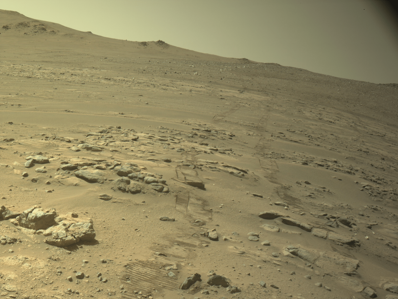
Perseverance now leads the cumulative distance driven by vehicles on the surface of another world. On October 11, 2026, NASA’s rover reached 45.22 kilometers on Mars, surpassing Opportunity’s 45.16 kilometers. The agency announced the result on October 12. The number records the mission’s entire journey up to that date, not a single drive or the distance between Earth and Mars.
The difference between the records may seem small, but it provides an opportunity to understand robotic exploration. Driving farther does not, by itself, mean finding life or making a scientific discovery. Movement brings different terrain within reach, while cameras, instruments and research teams give meaning to what appears along the way. These five points explain the record, navigation and scientific work without turning an engineering achievement into a conclusion the data cannot support.
1. What the Perseverance record measures
The milestone was reached on mission sol 2,006, approximately five and a half years after landing. Sol is the count of Martian days used in operations. Opportunity accumulated its distance over almost fifteen years. The comparison recognizes the evolution of these missions, but the figures are not a race under identical conditions: each vehicle faced different equipment, terrain, activities and constraints during its operation.
To interpret this kind of update, always consider three pieces of information together: what was measured, in which unit and on what date. Total distance does not tell you the speed of a particular drive. Dividing the total by every day of the mission also combines periods of movement with research stops. If a publication gives another figure in the coming months, it may simply reflect additional travel without invalidating the record announced now.
2. How Perseverance chooses its path
NASA describes AutoNav as a system that can assess obstacles and adjust a route toward a previously defined destination. This does not mean the rover has been given freedom to choose all its scientific objectives independently. Deciding how to cross an area is different from deciding why to study it. Autonomy handles part of local navigation within a mission planned and monitored by people.
In February 2026, the agency introduced another capability: Mars Global Localization. The system compares panoramas from the rover’s cameras with orbital maps stored onboard to estimate its location. In the operational uses reported on February 2 and 16, it enabled the rover to locate itself without depending on identification from Earth. The official explanation cites approximately two minutes of processing and accuracy of around 25 centimeters for this task.
3. Why location also limits a drive
Mars does not have a GPS satellite network equivalent to the one used by phones on Earth. Visual tracking of terrain helps estimate position, but small errors can accumulate. A slipping wheel, for example, makes it inappropriate to treat every rotation as perfectly known forward movement. The localization upgrade does not build a road; it reduces uncertainty about where the equipment is within the available map.
A simple way to distinguish the functions is to ask two questions: is there an obstacle ahead, and where am I on the route? Identifying a rock answers the first but not necessarily the second. This distinction helps explain why improving localization can be as important as improving obstacle detection. It also avoids the conclusion that a machine capable of navigation does not need maps, planning or supervision.
4. Perseverance’s scientific purpose goes beyond the odometer
The mission’s public sample collection shows that the work is about more than covering kilometers. The catalog identifies samples, collection locations, dates and material types. It also distinguishes sample tubes from witness tubes, which document the cleanliness of the system. Of the 43 tubes brought to the planet, 38 were intended for sample collection and five for this monitoring, according to NASA’s page.
These distinctions matter when reading a story about Martian rocks. Material stored in a tube is not automatically a sample analyzed in a laboratory on Earth. An image of a sampling hole also does not reveal the rock’s complete composition on its own. When consulting the catalog, connect the sample’s name with its location and date rather than using an isolated photograph to draw conclusions about its origin.
5. How to follow upcoming results
The mission blog provides updates, while the catalog collects information about the samples. Use the two to answer different questions: what happened recently, and what is the context of a particular material? When reading a story, also distinguish observed results, researchers’ explanations and future plans. A goal announced for the next stage should not be described as a discovery already made.
The photograph in this article was captured by a navigation camera on October 11, according to its official caption. It shows terrain and wheel tracks, without AI reconstruction. It provides a visual record of the environment, but evidence of the record comes from the data published by the mission. To follow Perseverance, save the source along with its date: this lets you compare updates without confusing old images, cumulative figures and exploration expectations.
Verified sources
Record announcement · Explanation of autonomous localization · Sample catalog · More news on MundoBlox

Lucas, a 25-year-old from São Paulo, has found a vibrant space for his passion for games and technology in the Roblox universe. Owner of a blog dedicated to the platform, he dedicates himself to exploring the various virtual worlds, sharing tips and news, and analyzing the technical aspects that make the Roblox experience so captivating. His ability to write engaging articles turns his passion into valuable content for other enthusiasts. Living in São Paulo, Lucas reconciles his life in the metropolis with the creation of online content, building a bridge between the digital world of games and the world of technology.