

SGB, the Geological Survey of Brazil, brought journalists and communicators together on October 7, 2026, to present studies on geological and hydrological risks. The meeting preceded the International Day for Disaster Risk Reduction, observed this Tuesday, October 13. The most useful information for the public is that the agency’s products are public and can be consulted through its disaster prevention portal.
The initiative provides an opportunity to better understand the documents mentioned in news about landslides and floods. A map can help frame questions about a municipality, but reading it requires context. This guide explains how to begin a search and organize your findings, without turning a territorial study into a forecast for a street or home. The story comes from a recent official announcement; it has not been classified as a search trend.
1. Start with the official SGB portal
During the webinar, geologist Tiago Antonelli presented the institution’s studies and explained access to the data, according to its announcement. The portal brings together risk mapping, post-disaster assessments, hazard maps, urban development suitability studies and other materials. This variety matters: before opening a file, identify the question it is intended to answer. Documents with different objectives should not be treated as equivalent versions of the same map.
To organize your research, record the full product name, municipality and state. Keep the original page address alongside the file instead of relying only on an image received in a message. This small reference sheet lets you return to the publication and check whether information was cropped out of a screenshot. It also makes it easier to explain where the data came from, without presenting a personal interpretation as the technical team’s conclusion.
2. Distinguish the types of study
The institutional presentation describes risk mapping as identifying parts of a municipality’s territory that are subject to losses or damage from adverse geological events. Urban development suitability maps address the capacity of land for different uses. Post-disaster assessments record and characterize affected inhabited areas. These are different purposes, although they appear together on the same portal. The document’s title is therefore an essential part of the information.
A practical way to avoid confusion is to write the file’s purpose in one sentence before sharing it. If you cannot identify that purpose in the introduction or methodology, keep your uncertainty explicit. Do not replace a technical explanation with a stronger conclusion simply because it fits a caption better. A responsible post can say that a particular survey has been found and link to it, without issuing a diagnosis about properties or residents.
3. Check the date, legend and area covered
When opening SGB material, look for the survey date and publication date. They may represent different stages. Also read the legend, the boundaries of the study area and the methodological notes available in the document itself. The color of an isolated region in a screenshot does not explain what was classified. Preserve these elements when keeping a visual reference for study or for discussions with the municipal administration.
Consider a hypothetical example: someone shares only a colored crop, without a municipality, year or legend. It is not possible to reliably establish which place and classification it refers to. The next informative step is to locate the complete document, not guess what the colors mean. If there are two editions, compare their titles, dates and methods before claiming that a graphical change represents improvement or deterioration in local conditions.
4. Separate document research from current alerts
SGB materials help explain the territory, but this article does not assess the safety of any address or announce an emergency. For operational information about an ongoing situation, consult updated statements from the responsible agencies in your municipality. Do not use a place’s absence from a cropped map as permission to enter an area, or turn document research into travel guidance.
When reading news, observe whether a report cites a study, a monitoring bulletin or local guidance. Note the time and author of each piece of information, because different kinds of documents can circulate together on social networks. When sharing a link, include its original date. This helps prevent old information from appearing new simply because it has been forwarded again in a group.
5. Use the data to ask better questions
An SGB search can end with specific questions: which area did the survey cover? In what year was it conducted? Is there a later edition? Where is the methodology? Which agency can explain how this material applies to municipal planning? Gathering these questions with the source address makes a request for clarification more precise. You do not need to independently resolve everything in a specialized document to benefit from its public value.
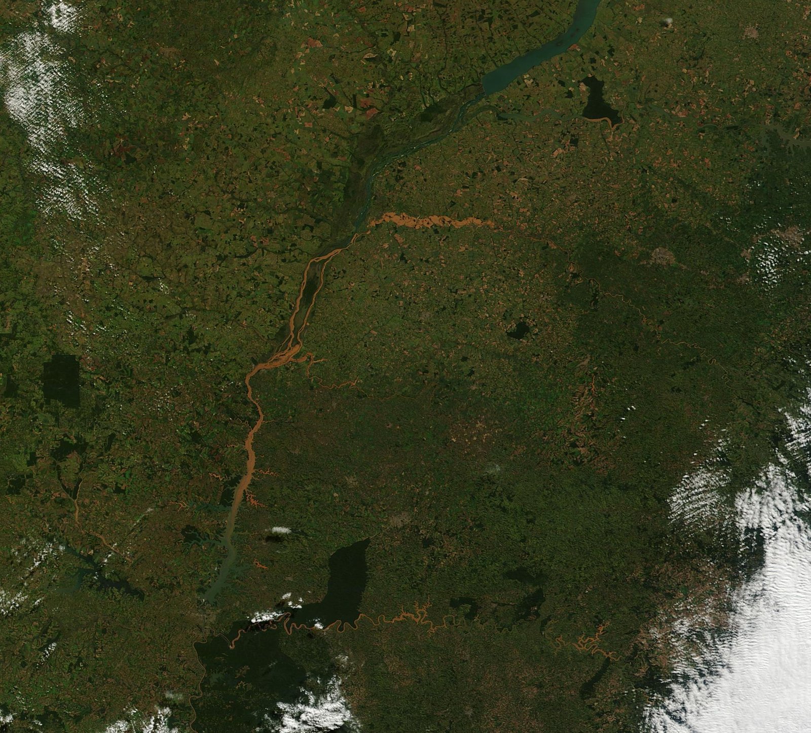
The image accompanying this article also requires context: it records rivers in Paraná in June 2014, according to NASA’s archive, and serves as a historical illustration. It does not show a disaster that happened today and is not an SGB map. The same discipline applies to any news photograph: checking origin, location and date is part of reading it. The links below let you directly consult the recent initiative and the institutional materials cited.
Sources consulted
SGB announcement of October 7 · Disaster prevention portal · More news on MundoBlox

Lucas, a 25-year-old from São Paulo, has found a vibrant space for his passion for games and technology in the Roblox universe. Owner of a blog dedicated to the platform, he dedicates himself to exploring the various virtual worlds, sharing tips and news, and analyzing the technical aspects that make the Roblox experience so captivating. His ability to write engaging articles turns his passion into valuable content for other enthusiasts. Living in São Paulo, Lucas reconciles his life in the metropolis with the creation of online content, building a bridge between the digital world of games and the world of technology.